
The Foundational Story of Green Miles in Thiruthiyamalai
A Village Once Fed by Water, Now Starved by Drought: Thiruthiyamalai, a small agrarian village in Southern India, once thrived on water. With a rich cultural heritage, fertile red soil, and a 70-hectare ancestral lake at its heart, it stood as a model for self-sufficient rural living. Generations of farmers cultivated millet, groundnuts, and native crops fed by seasonal rains and groundwater drawn from over a hundred household wells.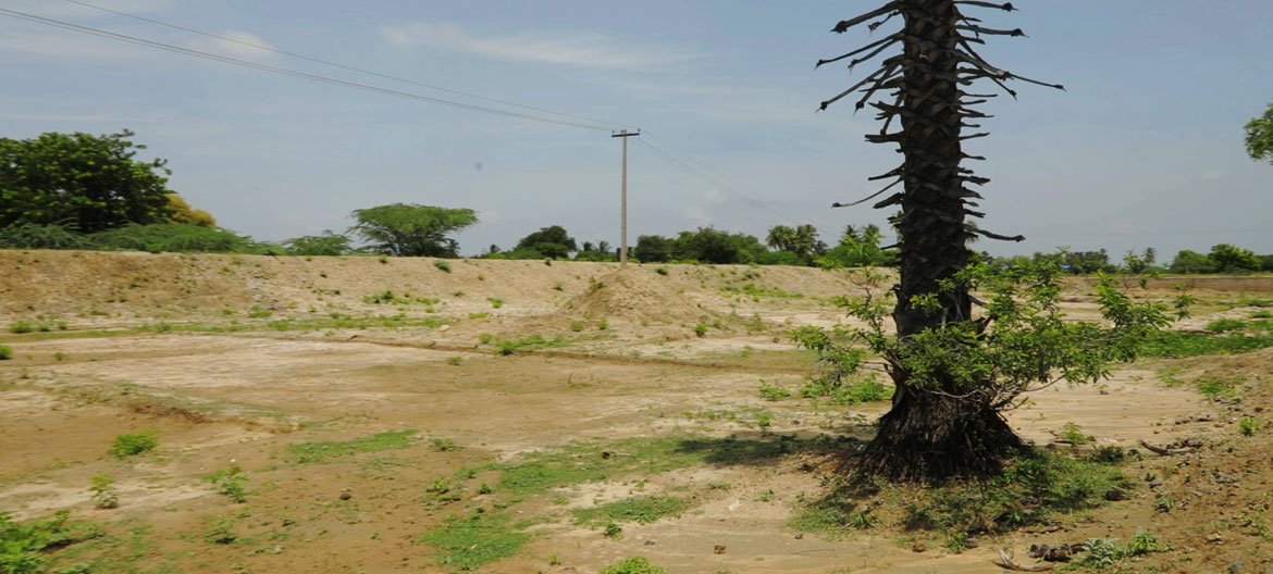
But that story changed.

Over the last two decades, erratic monsoons, climate volatility, and poor surface recharge turned abundance into scarcity. The village’s aquifers began to recede. Wells ran dry. The once-productive lake cracked into dust. Agricultural activity shrank, incomes disappeared, and rural youth began to migrate. “We had no water. Only debt. No crop would survive. Many of us stopped even trying.”
Understanding the Water Geometry
Studies commissioned by Chiasm Dais Trust revealed a critical truth: Thiruthiyamalai sits just ~12 km from the abundant Cauvery River, but due to elevation (92m MSL) and poor infrastructure, this life-giving source remained inaccessible. The village’s terrain—marked by pediplains and weathered granite beneath was ill-suited for deep aquifer retention without surface interventions.
- Effective rainfall (usable for crops): Declined from ~350mm to ~298mm/year
- Aquifer recharge capacity: Only ~15% (could be doubled with right measures)
- Estimated watershed restoration potential: ~0.5 TMC/year (~14 billion litres)
- This data was the genesis of Green Miles.
The Turning Point: A Plan Rooted in Nature & Engineering
Green Miles Phase I set out to reimagine water access not as a crisis to fear, but as a system to rebuild:
- A 12.619 km underground water pipeline from Mukombu Dam (Cauvery River) to Thiruthiyamalai was planned.
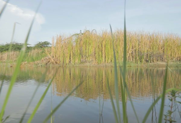
- Water would be pumped with elevation gain, passed through 4 intermediary villages, and fed into the ancestral 70-hectare lake.
- The lake, once filled, would begin recharging 100+ dry wells spread across 5–6 sq.km.
- An aquifer rehabilitation plan would enable 500+ hectares of farmland to return to cultivation.
- Collection efficiency (currently ~15%) would be boosted to ~30% using surface + sub-surface recharge methods.
- This is not just irrigation—it is environmental revival, economic restoration, and social healing, intertwined.
Within 90 Days
1.3m depth of the lake restored
Within 180 Days
Up to 4.5m lake depth restored
Initial recharge triggers wells in nearby households
Within 1 Year
Full 8.6m lake depth capacity achieved (~10.8 million cu.m water)
100+ wells and 500 hectares of farmland reactivated
Groundwater levels rise, reducing future climate risk
By Year 2
Lake consistently recharges at ~0.5 TMC/year
Community-led maintenance and governance models established
Pipeline ownership shared across 4 adjacent villages
Beyond Infrastructure: Why General = Foundational
The General Section isn’t just a project category—it represents the philosophical base of Green Miles:”If you want to heal a community, start by healing its water.”
By restoring this one lake and reconnecting a village to its natural water cycle, we unlock:
- Income restoration through agriculture
- Debt reduction for marginal farmers
- Reverse migration through local employment
Hope as a measurable output
This water is not just physical; it’s political, emotional, spiritual, and ecological capital.
In Thiruthiyamalai, the Green Miles General Program is not about one pipeline or lake.
It’s about showing what happens when you treat a village as an ecosystem.
Water is only the first drop in a flood of possibility.